Port Jackson (Sydney 1788) [v2 in description]
VERSION 2: https://steamcommunity.com/sharedfiles/filedetails/?id=1566028540
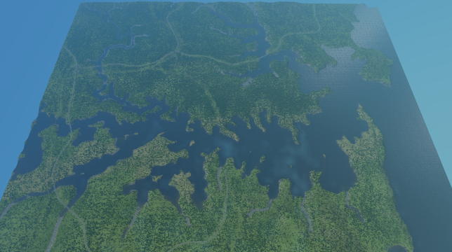
A map of Port Jackson (now Sydney, Australia) as it was prior to European settlement.
This map was constructed with reference to 18th-century maps of Sydney Harbour, and includes its original rivers, harbours and islands. Notable differences include Darling Harbour and Sydney Cove (now Circular Quay) in their original form before land reclamation, and Garden Island still detached from the mainland. The Tank Stream also still flows through what is now the heart of the CBD.
Trees, roads and resources were placed where they felt natural. Feel free to recommend improvements!


