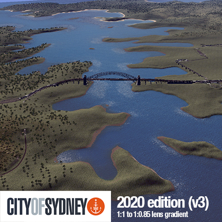
Sydney, Australia (v3)
This is my third and hopefully last attempt at editing a map for Sydney, Australia.
I’ve been frustrated with my last two attempts by what I have to crop out, what will be counted as "Sydney". I want to fit in as much as possible, including key areas of industrial logistics and connections, such as Port Botany and the airport. This is in tension with my desire to have the map be 1:1 scale.
In truth, all I really wanted was 1:1 scale *in the CBD*. This map compromises both desires with a sort of dilation effect. I set up a boundary, inside which everything is 100% scale. Then I gradually shrank the map scale outside this zone until it was 85.7% scale. It’s almost imperceptible, in my opinion. Now the map includes Chatswood to the middle of Botany Bay. It includes Manly beach and Rhodes.
You can download a map overlay here[drive.google.com]. It is ever so slightly off as you get further away from the center, but resetting it will line it back up with the CBD.
It also features substantial improvements to the road and rail network that comes pre-built. In my last map, there were only two meaningful outside connections. The M2 flowing through to the M1. As I expanded westward that corridor maintained all the pressure, so getting in and out of Balmain was a nightmare for trucks and goods vans. This map increases the number of outside connections. It exits north after the Spit Bridge on the A8, after Lane Cove River on the M2, exits shortly after West Ryde on Victoria Road (A40), and the M5 exits around Kingsgrove. It features interchanges related to these major arteries at Gladesville, North Sydney, Lane Cove, Western Distributor, Balmain. It includes the Harbour tunnel and the Cross City tunnel. It includes the Harbour Bridge (by BadPeanut), the Anzac Bridge (by me), and simple versions of Iron Cove Bridge, Gladesville bridge, and the Spit Bridge.
For trains, it includes the T1, T2 and T8 train lines, and a rough sketch of the interchange for freight heading for Port Botany. It cuts off at Chatswood to try and prevent freight and intercity trains spawning and travelling down the north shore line.
Ship lanes both into the harbour and Botany Bay, and air traffic lanes running along the angles of the airport.
Pretty light on nature detailing. Uses clus’s concrete highways. Sorry about all the dependencies.. clus’s highways had a number of advantages over the vanilla ones, thinner tunnel entrances, etc.
Donate[paypal.me]
Required items:
Click the title to search on this site.
1L - Concrete Highway — Steam Workshop
1L - Concrete Highway - Barrier — Steam Workshop
2L - Concrete Highway — Steam Workshop
3L - Concrete Highway — Steam Workshop
4L - Concrete Highway — Steam Workshop
5L - Concrete Highway — Steam Workshop
Anzac Bridge — Steam Workshop
AussieBushShrubs — Steam Workshop
Blue Gum — Steam Workshop
Fine Road Anarchy 2 — Steam Workshop
Concrete Retaining Wall network — Steam Workshop
Sydney Harbour Bridge — Steam Workshop
Quay Anarchy — Steam Workshop
Prop & Tree Anarchy — Steam Workshop
Long Grass Pack — Steam Workshop
Gumtree Cluster Smooth Bark — Steam Workshop
Gumtree Cluster Rough Bark — Steam Workshop
Gum Trees — Steam Workshop
Basic Slope Profiles — Steam Workshop


