Sinagua – Official Map
This is the official map from Czardus’s Sinagua let’s play series on YouTube. This was a Cities Skylines vanilla (almost) let’s play series focused on building a city with limited custom mods or assets.
The map theme in use is Arrowhead Valley (Official Map Theme) by Flux and Strictoaster. Please make sure that you have all of the required assets found on the right side of the screen along with the mod Network Extensions 2.
This is a moderately challenging map. There is very little water available, so I recommend using water towers for your water intake. The starting interchange may also cause some challenges for the player, as it goes right into an intersection of two national highways. This is an intentional choice to force the player to move away from the starting square and make other strategic choices. The player also will need to choose between building in the mostly flat valley or using that as fertile land, building on some dry lakebeds or utilizing the oil resources, and whether to dig into some of the cliffs to access the ore resource.
The river can be used for a hydroelectric dam; however, you will need to use the mod Extra Landscaping Tools (https://steamcommunity.com/sharedfiles/filedetails/?id=502750307) in order to modify the locations of the water sources to get the dam to work. I did this in my series, though it took several videos to get it set up properly.
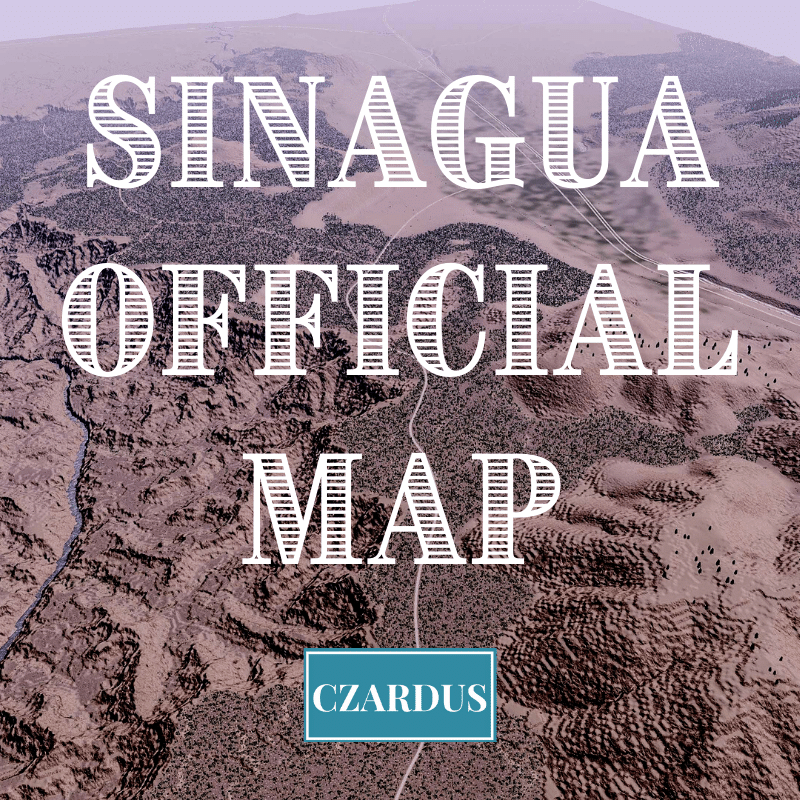
To make the map, I’ve taken a heightmap of the Grand Canyon and combined it with a heightmap of the Flagstaff region to create a vibe that should feel right for the American Southwest. This results in some great topographic features on the map including:
– A giant canyon (obviously)
– A tall mountain (Humphrey’s Peak)
– Several small crater-like mountains
– Massive terrain changes across a lot of the map
I’ve also researched a bit of the foliage that appears in different parts of the region, resulting in several different biomes including:
– Pinyon Forest
– Ponderosa Pine Forest
– Mixed Confier Forest
– Canyon Riverbed
– Desert Scrub
– Desert Grassland
Forest Brushes: My Patreon supporters can access the data to have the forest brushes from the different biomes here: https://www.patreon.com/posts/sinagua-forest-49248298
Finally, the map has some national highways following what I imagine would have been the original wagon trails through the region, along with a couple of interstate highways which would have been added later and are much less friendly to the terrain as they cut across the map.
Required DLC:
These DLC should be installed in order to use this item.
Cities: Skylines - Mass Transit
Required items:
Click the title to search on this site.
Arrowhead Valley (Official Map Theme) — Steam Workshop
Network Extensions 2 (Updated for Sunset Harbor) — Steam Workshop
Acacia Tree — Steam Workshop
Bushy Grass — Steam Workshop
Juniper — Steam Workshop
Norway Spruce 2 — Steam Workshop
PineBush — Steam Workshop
Ponderosa pine tree — Steam Workshop
Shore Pines — Steam Workshop
Ponderosa pine tree 2 — Steam Workshop
The Shady Bush — Steam Workshop
Wild Bush Plants — Steam Workshop
Douglas Fir Forest Pack — Steam Workshop
Wild Hedges — Steam Workshop


