Saint-Etienne, France
*********************************************************************************
WARNING
*********************************************************************************
This map is not up to date now. You can grab the version 1.1 here:
https://steamcommunity.com/sharedfiles/filedetails/?id=2609769386
This outdated version stays so that players who started a city on it don’t lose the base map.
*********************************************************************************
ABOUT SAINT-ETIENNE
Saint-Etienne is a city located in center-east of France, and is my hometown. It is inhabited since the middle ages, but really blossomed during the industrial revolution, due to the power provided by its massive coal ressources and the waters of the Furan stream. With the depletion of coal mines and the shut down of weaponery factories, the city experienced an economic decline during the late XXth century, of wich it is still in the process of recovering.
Fun fact: the split line between the Loire and Rhône watersheds crosses this map. This means, a drop of water that rains in the eastern part of this map will run to the Meditarranean Sea via the Janon stream and then the Rhône, while a drop that falls in the western or central area will join the Atlantic Ocean via the Loire.
MAP MAKING CHOICES
Heightmap is from cs.heightmap.skydark.pl.
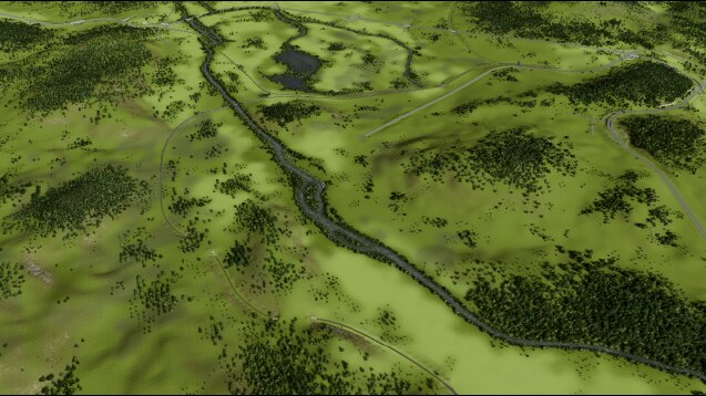
If you know Saint Etienne well, you will notice the rivers are larger in this Cities Skyline edition than in real life. This is a choice i made because they are really small: if i made them in real size they wouldn’t look realistic nor good with the weird water dynamics of our favourite game.
You will also find a swamp, that have been drained in real life and became a neighborhood. I decided to keep the original swamp in this map, and you will be free to make whatever you want with it.
The sources have usually a low level, so that putting just about 2 meters of soil over it will dry them and allow you to build on it. Same goes for the rivers in the valleys. You will find higher sources in the Pilat mountains (south), so that you can build power dams (out of the 25 tiles area).
I didn’t want to put too much human made infrastructures in order to leave as much freedom as possible to the player. So you’ll find mostly motorway and rail networks. Nevertheless, i added a few main avenues so that most tiles have an acces to the motorway by default.
TIPS FOR BEST LOOK
– You may want to have the sun rising from the east and moving to the west. I rotated the map so that this realistic sun travel is achieved with the "classic" sun position (you will need the daylight classic mod).
– The map theme I use is Wet Temperate. But Laviante 2.0, NotSoRocky Hills and Revi 4K will provide good results too. Chose to your liking.
– This map is intended to be played with "No orange/dead trees at shoreline areas" activated, since there is a lot of vegetation arould the rivers, and no sea (thus, nothing ruined by salt). I use the Laviante LUT.
ACKNOWLEDGEMENTS
I used a lot of mods, resources and themes from the community, therefore i wanted to say thanks to everyone involved. This map wouldn’t have been possible if you guys didn’t put so much work into making Cities Skyline even better than it is. Furthermore, seing so much mods gave me the motivation to dive in this project.
Avanya (Wet Temperate map theme)
boformer (Random Tree Rotation)
BloodyPenguin (Daylight Classic, No Radioactive Desert And More!)
kjmci (Unlimited Trees: Revisited)
Lost Gecko (Generic Tree pack)
MrMaison (Young Trees)
pdelmo (trees, many!)
ryanjamesoflondon (fern 1)
sniggledigit (Network Extension 2)
I consider this map a version 1.0 at this stage. This is the first map i create, so i’m very open to any suggestion, advice or constructive criticism. Don’t hesitate to tell me about your experience with it!
Happy game ! 🙂
Required items:
Click the title to search on this site.
Ash Tree — Steam Workshop
Beech_Tree — Steam Workshop
Daylight Classic — Steam Workshop
Young Trees — Steam Workshop
Generic Tree pack — Steam Workshop
Laviante Lut — Steam Workshop
Leafy Tree by pdelmo — Steam Workshop
Leafy Tree Set — Steam Workshop
Network Extensions 2 (Updated for Sunset Harbor) — Steam Workshop
No Radioactive Desert And More! — Steam Workshop
Random Tree Rotation — Steam Workshop
Regular Trees 4 pack — Steam Workshop
Tall Grass Clusters — Steam Workshop
Ultra low tri trees — Steam Workshop
Unlimited Trees: Revisited — Steam Workshop
Wet temperate map theme — Steam Workshop
Fern 1 — Steam Workshop
Filler Grass — Steam Workshop


